练习二:

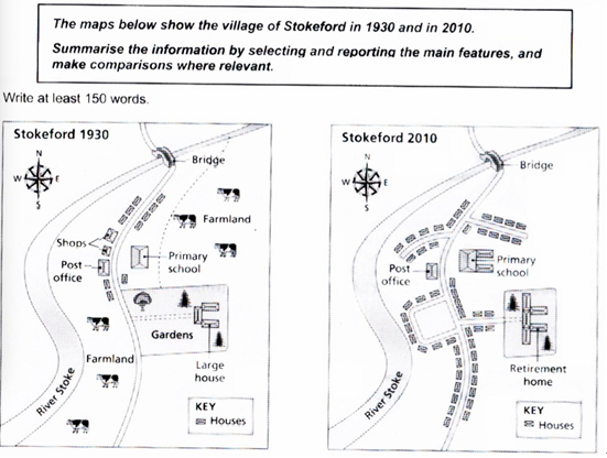
Illustrated in the map is how the village of Stokeford changed over the period from 1930 to 2010.
As can be seen from the map, the village was unexploited and natural, with a north-south river in the west, which was crossed by a paralleled road in the north. A bridge was constructed over the intersection. Several shops and a post office were built along the western side of the road while a great number of houses, a primary school, and a garden with a large house inside were located opposite. Two expanses of farmland were situated on the two sides of the road.
However, after 80 years, the village accelerated its pace of development, with more houses being established along the main road and its branches, replacing the original shops and garden. And also, the size of the primary school was expanded, doubling its previous scale. Besides, the former garden gives way for the newly-built retirement home. However, all the farmland disappeared.
Overall, the village experienced a prosperous transformation and becomes a modern place for people to live.


